Consumer Insights
Uncover trends and behaviors shaping consumer choices today
Procurement Insights
Optimize your sourcing strategy with key market data
Industry Stats
Stay ahead with the latest trends and market analysis.
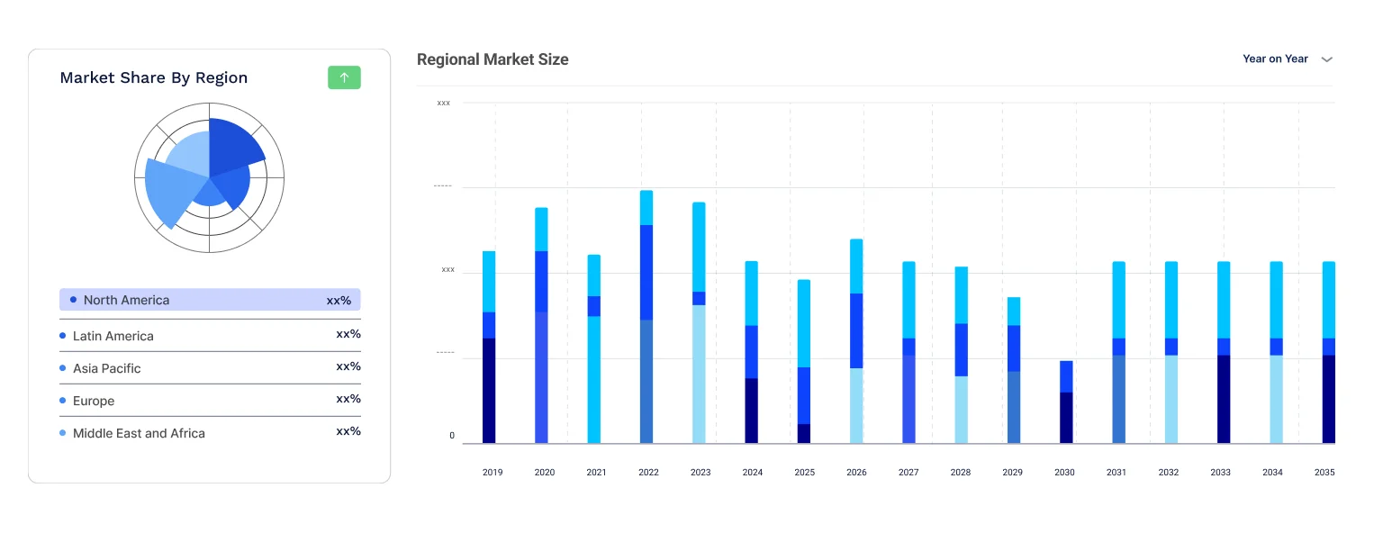
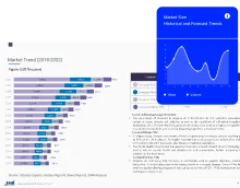
The global digital map market size reached around USD 11.71 Billion in 2025. The market is projected to grow at a CAGR of 13.90% between 2026 and 2035 to reach nearly USD 43.03 Billion by 2035. The market is being driven by increasing demand in automotives and widespread usage of mobile devices. Growing demand for digital maps in navigation, logistics, and smart city planning drives the digital map market at a fast pace. Most current technologies in map making and surveying have improved accuracy, benefiting industries such as transport, real estate, and urban development. With the advent of smartphones and other connected devices, the continued reliance on map-based applications for real-time navigation has further increased. The rise of personal navigation devices also encourages growth in the market. However, mobile integration continues to obstruct independent device sales. Businesses have successfully used digital maps for location-based services in optimizing the fabric of the operations.
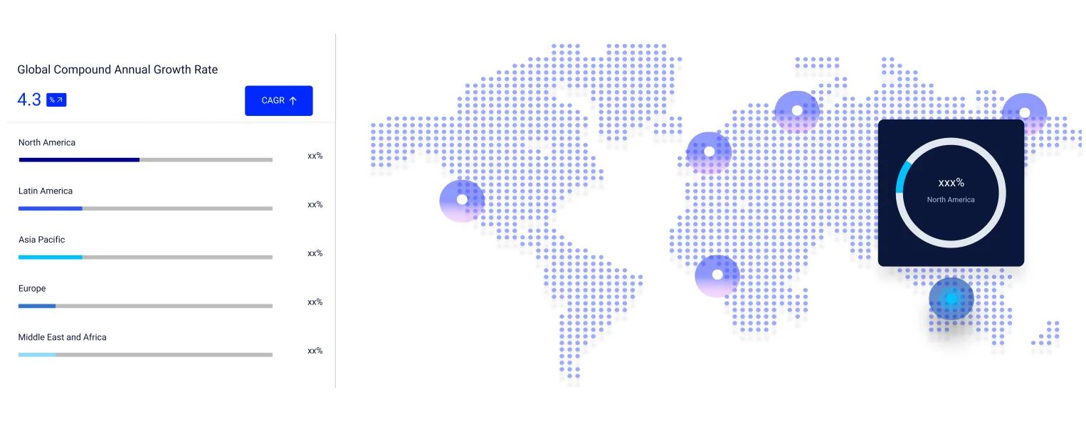
Compound Annual Growth Rate
13.9%
Value in USD Billion
2026-2035
Read more about this report - REQUEST FREE SAMPLE COPY IN PDF
The digital map market share is rising due to technological innovations and increasing use of mapping applications across industries. GPS, geomatics systems, and high-resolution imaging improve accuracy for navigation, urban planning, and infrastructure development. The automotive sector, including ADAS and self-driving cars, relies on precise real-time maps, while logistics and fleet management use mapping for route optimization and tracking.
Advances in AI, remote sensing, and automated mapping systems further strengthen the market share. Real-time updates from satellites, drones, and high-precision sensors support autonomous driving, urban development, and disaster management. High-definition (HD) maps enhance efficiency and accuracy, driving adoption across sectors that require reliable, real-time geographic data.
The market for digital maps is growing because of technological innovation in mapping and more dependence on digital mapping applications in different sectors. Geomatics systems and images enhance precision, enabling navigation, urban development, and infrastructure construction. The automotive industry plays a crucial role, integrating Global Positioning System (GPS) and Advanced Driver Assistance Systems (ADAS) to improve driving experiences. Self-driving cars depend on high precision mapping systems, fueling demand for real-time updates. Moreover, since logistics control systems and fleet management solutions use mapping for route optimization and tracking, a right collaboration with mapping partners gives companies high-quality data. As autonomous technologies evolve in the automotive industry, self-driving cars, together with technologies bolstered by artificial intelligence, will continue to shape the future of navigation and location service solutions.
The market observed advancements taking place in geospatial technology which has driven digital maps industry by improving accuracy and real-time information processing. Devices augmented with Global Positioning Systems (GPS) and Geographic Information Systems (GIS) is being increasingly used for managing disasters, developing urban cities, and finding out routes. Geofencing and geocoding technologies are also used. These enhance location-based services and hence support logistics and retail businesses. Earth Observation (EO) information from drones and small satellites boosts mapping accuracy. High-Altitude Pseudo Satellites (HAPS) and satellite constellations are just two of the technologies that expand global coverage to remote areas. The applications of these technologies are driving growth in the digital map market because of growing demand for accurate location services.
The market growth is further fueled by advances in digital map constructions along with more precise data collection. Advanced sensors play central roles in gathering detailed geographical data that makes mapping more precise. Technology makes effective data collection possible with real-time updates from satellites, GPS, and remote sensing. AI and machine learning are used to handle big data to create data sets with accurate maps for autonomous cars, urban planning, and navigation. The growing need for real-time mapping keeps driving developments in the field of technology. Demand in the digital map sector is rapidly increasing due to the development of automated mapping systems, which make it simpler to create maps and analyze data for usage.
Furthermore, the growth of automated mapping systems, which facilitate easier map creation and data processing for use, is fueling demand in the digital map market at a fast rate. The precision and effectiveness of navigation devices are enhanced by these systems, especially for the Advanced Driver Assistance System (ADAS) of modern cars. High-definition (HD) map demand is on the increase since industries need accurate, real-time geographic information. An automated mapping solution guarantees a digital representation of reality, offering detailed insights for urban planning, logistics, and autonomous driving. With the development of technology, high-precision map creation continues to transform industries that depend on location-based services and smart navigation systems.
Geographic Information System (GIS), as per the digital map market analysis, is on the rise due to effective decision-making with high-resolution imagery captured from aerial or satellite platforms of detailed views of the earth surface and orthorectification-an image that is geometrically corrected to remove distortions from cases like terrain and camera angles. These make the imagery right for detailed measurements and mapping.
LiDAR also plays an important role in improving the accuracy of data because of detailed topographical information. Digital Orthophotography and aerial photography provide high resolution images for detailed mapping. Global Positioning System (GPS) integration supports reliable location data for various GIS applications. Proper integration of GIS with software allows for better analysis of data with urban planning, environmental monitoring, and infrastructure development. More data processing and visualization capabilities in software solutions enable GIS to be made very accessible. Services improve accessibility by enabling GIS customization.
Advances in computerized and scientific techniques are major driving forces for the overall growth of the digital map market. By automating complex tasks, enhancing precision, and facilitating real-time processing of data, computerized systems enhance mapping abilities. Enhanced analysis and decision-making are achieved in engineering, transportation, and medicine whereby computational capability is incorporated. Such scientific methods contribute to the functionality of systems by offering stringent data analysis techniques.
GPS navigation enhances functionality through facilitating precise positioning, real-time route planning, and optimal pathfinding, the fundamental elements for contemporary navigation systems. This permits users to access information that furnishes accurate real-time data support for differential decision-making. Computerized systems, scientific computation, and integration of data with GPS navigation all work together to push efficiency, precision, and overall effectiveness of various applications through process optimization, improved user experience, and improved output in complex situations. All these elements increase the efficiency of systems, delivering functional and scalable solutions.
Increasing demand for consulting, development and integration, and support and maintenance is propelling the market for digital maps. Consulting services aid in understanding the requirements of the clients and offering tailored solutions that can guide businesses through their intricate problems. Professionals in the industry give out strategic advice that assists companies in refining their processes, embracing new technologies, and cultivating efficiencies in their operations.
Development and integration services entail the construction of systems that are tailor-made to suit the precise needs of customers. This begins with the creation of sound technical solutions, which will ensure smooth integration into existing infrastructures while thinking about future scalability. Further, efficient development encompasses testing and quality assurance to confirm the performance of the system.
Additionally, once the systems are installed, the support and maintenance services ensure the required work to guarantee that they operate flawlessly. Businesses can improve performance, decrease downtime, and quickly resolve technical issues by upgrading, maintaining, and providing assistance. These services are essential for preserving enduring customer connections and making sure that systems adapt to changing requirements and advancements in technology. Together consulting, development and integration, and support and maintenance are all part of a total service model that benefits businesses in simplifying operations, enhancing system capabilities, and achieving sustainable growth in the competitive marketplace.
Mapping types that are likely to foster development in the digital map industry include indoor, outdoor, and metaverse spaces. These are increasingly propelled by advances in spatial technology, data gathering methods, and consumer experience expectations. Indoor mapping is developed from the needs of real-time precise spatial data for navigation and use of areas in buildings, particularly large or geometrically intricate buildings like malls, airports, and hospitals. Technologies such as LiDAR, RFID, and Bluetooth Low Energy (BLE) enable the development of interactive and detailed indoor maps that guide users through ever-changing environments while optimizing facility management.
Outdoor mapping, on the other hand, offers geographic data along with environmental monitoring, urban planning, and navigation. GPS, satellite imagery, and drone technology are increasingly used to acquire topographic data that enhance mapping accuracy and real-time updates. Applying augmented reality in outdoor mapping gives insights about the surroundings for knowledge seekers, city planners, and field workers.
Mapping in the metaverse is linked to 3D modeling, immersive virtual worlds, and spatial computing whereby it creates an interactive digital space where gaming, socialization, and commerce take place. This technology changes the ways in which the users interact with real and virtual worlds, thereby elevating their experiences while opening doors of possibilities in mapping applications.
Technology and practical needs play a major role in determining the basic factors that influence demand for applications, particularly in asset tracking, geo-positioning, geo-coding, routing, and navigation. Asset-tracking applications improve productivity and security in sectors including manufacturing, shipping, and healthcare by using GPS, RFID, and Internet of Things (IoT) sensors to track the position and condition of assets in real-time. In order to enable mapping services and ensure precise placement for usage in both personal and professional contexts, geopositioning and geocoding technologies supply essential location-related data. Apps for routing and navigation use artificial intelligence (AI), machine learning, and real-time traffic data to guarantee the best routes, saving money and time.
On the other hand, indoor applications concentrate on achieving spatial awareness within enclosed facilities. Some examples include smart building management systems and indoor navigation systems that rely on Bluetooth and Wi-Fi. Outdoor applications rely on location-based services in open spaces. Here, GPS and satellite imagery are mainly used for application areas including hiking, delivery services, and urban planning. Such applications work together to improve efficiency, comfort, and decision-making in different industries covering indoor and outdoor spaces.
One of the main factors propelling the digital map market in the automotive sector is the increased need for sophisticated navigation systems, real-time traffic information, and more engaging in-car experiences. As autonomous driving technology advances, digital maps provide vital information for safe driving, vehicle navigation, and the best possible route planning. In addition, an even higher demand for accurate, current mapping exists as the number of connected cars and Internet of Things (IoT) usage continues to grow.
Defense and military solutions use high-resolution digital maps to facilitate strategic planning, navigation, and situational awareness, especially in challenging terrain. Mobile devices use digital maps because they enable location-based applications like navigation, geospatial analysis, and augmented reality. Asset tracking, fleet management, and logistical optimization for enterprise solutions are made possible by these maps, which give businesses real-time visibility into locations and resources. The travel, logistics, and transportation sectors all use digital maps to plan routes, save fuel, and generally improve operations.
Additionally, digital mapping is essential to the development of infrastructure and construction for site planning, design, and monitoring, which improves the timeliness and accuracy of projects. They are also employed by the government and utility industries to enhance decision-making and use of resources in urban development, emergency operations, and public service delivery. Combined, they illustrate the extent to which digital mapping is significant to different industries for facilitating market growth and innovation.
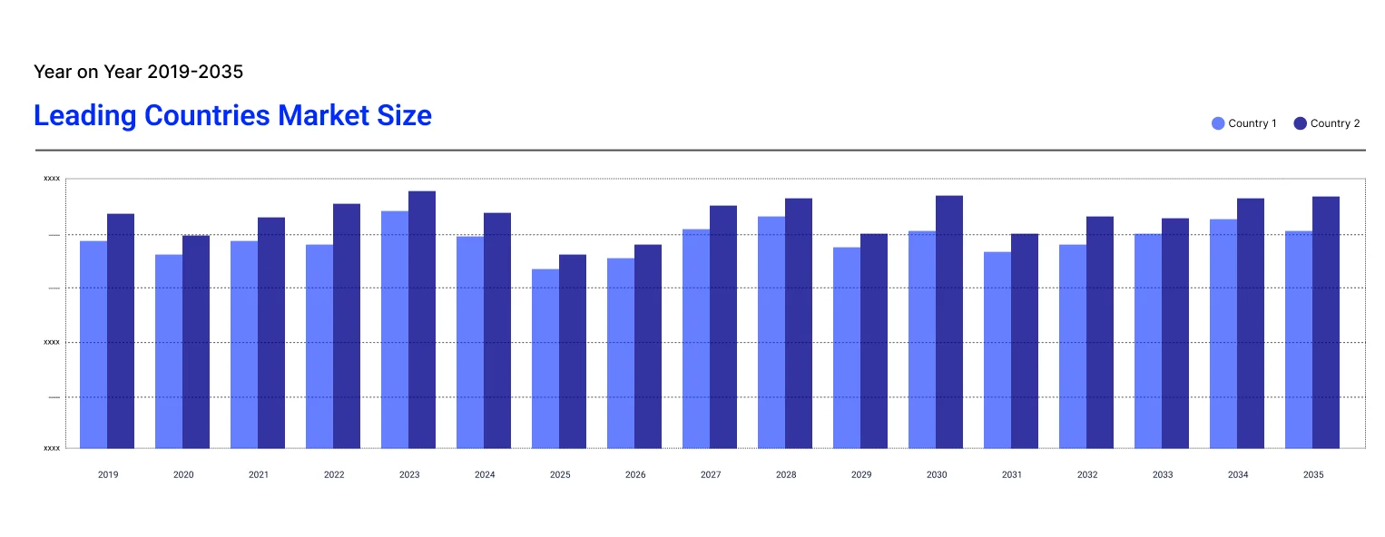
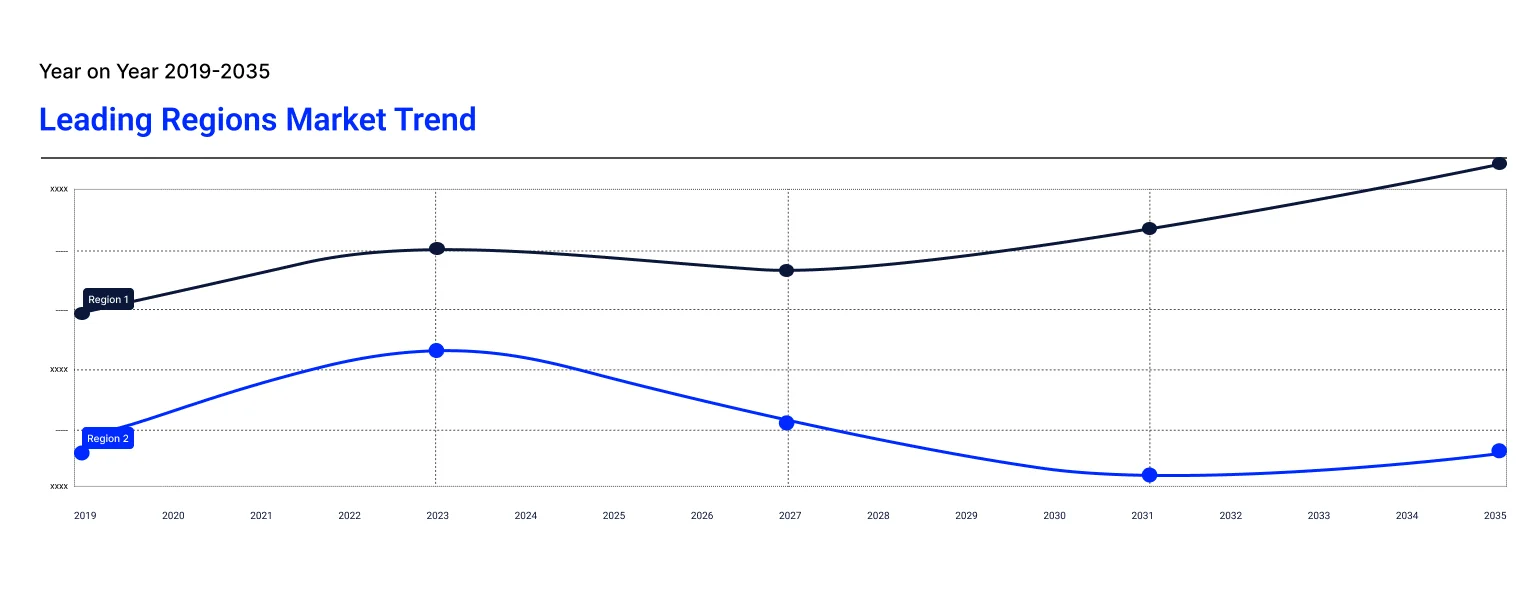
The demand for properly structured regional mapping and infrastructural planning in the emerging economies is on the rise with the use of sophisticated technologies like GPS, IoT, and data analytics. This technology allows governments, business, and organizations to make rational decisions on resource dispersion, urban planning, and economic development. Economic development in the Asia Pacific also drives the demand with growing sectors like logistics, agriculture, and transportation that require precise data to enable operational optimization. On the other hand, coastal regions prioritize climate monitoring and flood control, while rural regions center their efforts around agricultural productivity and land management.
In the developed markets such as in North America and Europe the growing demand stems from smart cities, transport optimization, and digital infrastructure. Regulations by the government and policies influence growth directly affecting decisions regarding environmental protection, infrastructure investments, and resource management. Further, the growing importance of sustainability and climate change mitigation massively drives digital map demand as policy officials and organizations search for ways to adapt and mitigate core environmental issues.
Digital map market players are increasingly working toward real-time integration of data within maps for enhanced accuracy, enabling the inclusion of geospatial technologies. They are increasingly focusing on enhancing the fundamental features with better mobile and IoT integration, AI-enabled features for route optimization, broader geographic coverage, and tailored mapping solutions for industries such as automotive, logistics, and urban planning.
Established in 1976 and based in California, United States, Apple Inc. is a notable player in the digital map market. Apple Maps is one of the company’s flagship products that provides navigation, traffic data, and location-based services deployed on various devices including iPhones and Macs. To develop improvements in user experience, Apple continues strikingly focusing on AI-driven features in mapping, including real-time data support.
Established in 1998, Google LLC is one of the most dominant players in the digital mapping industry. Google Maps has been providing mapping services, navigation services, and street views across the globe. Google has colossal data infrastructure to drive accuracy in mapping, real-time traffic information, and location-based services and to specialize innovations in mobile navigation and geospatial analytics.
Founded in 2001 with its headquarters located in Beijing, AutoNavi Holdings Ltd. dominates the Chinese digital market with mapping, navigation, and location-based services. It is especially known for its Amap platform, which provides local mapping solutions specifically for the Chinese market, targeting the automotive, mobile, and government sectors.
Founded in 1985, HERE Holding Corporation is based in Netherlands. The company is a leading provider of location data and mapping solutions. They provide navigation, mapping, and geospatial data services to consumers belonging to automotive, logistics, and enterprise sectors through their HERE Maps platform. This platform focuses on precision, real-time updates, and advanced analysis in mapping solutions.
*Please note that this is only a partial list; the complete list of key players is available in the full report. Additionally, the list of key players can be customized to better suit your needs.*
The study on digital map market delivers detailed analysis on region-level perspective depending on specific contemporary industry trends. It considers various segments, such as type, functionality, services, mapping type, application, and end use. By assessing all these segments, this report presents a thorough discussion of market drivers, regulations, and emerging opportunities observed in the market.
Type Outlook (Revenue, Billion, 2026-2035)
Functionality Outlook (Revenue, Billion, 2026-2035)
Service Outlook (Revenue, Billion, 2026-2035)
Mapping Type Outlook (Revenue, Billion, 2026-2035)
Application Outlook (Revenue, Billion, 2026-2035)
End Use Outlook (Revenue, Billion, 2026-2035)
Region Outlook (Revenue, Billion, 2026-2035)
Upto 15% Off
USD
$2499 $2249
$3999 $3599
$4999 $4249
$5999 $5099


*While we strive to always give you current and accurate information, the numbers depicted on the website are indicative and may differ from the actual numbers in the main report. At Expert Market Research, we aim to bring you the latest insights and trends in the market. Using our analyses and forecasts, stakeholders can understand the market dynamics, navigate challenges, and capitalize on opportunities to make data-driven strategic decisions.*
The market is projected to grow at a CAGR of 13.90% between 2026 and 2035.
The digital map market size is estimated to reach USD 43.03 Billion by 2035.
The key driving factor of the market growth is the increasing demand for digital maps in navigation, logistics, and smart city planning initiatives.
The key trends of the market include the development of enhanced sensor technology, increasing use of consumer-centred applications, growth in the number of software providers, and rapid technological advancements.
The major regions in the market are North America, Europe, the Asia Pacific, Latin America, and the Middle East and Africa.
The significant applications of digital maps in the market are asset tracking, geo-positioning and geocoding, and routing and navigation.
The major market players, according to the report, are Environmental Systems Research Institute (ESRI), Inc., Google LLC (Alphabet Inc.), TomTom NV, Mapbox, Inc., Maxar Technologies Inc., Apple, Inc., HERE Global B.V., AutoNavi Holdings Ltd., Getmapping PLC., Intermap Technologies Corporation, NavInfo Co., Ltd., and Zenrin Co., Ltd., among others.
The leading segment considered in the market report is type.
In 2025, the market attained a value of nearly USD 11.71 Billion.
Explore our key highlights of the report and gain a concise overview of key findings, trends, and actionable insights that will empower your strategic decisions.
| REPORT FEATURES | DETAILS |
| Base Year | 2025 |
| Historical Period | 2019-2025 |
| Forecast Period | 2026-2035 |
| Scope of the Report |
Historical and Forecast Trends, Industry Drivers and Constraints, Historical and Forecast Market Analysis by Segment:
|
| Breakup by Type |
|
| Breakup by Functionality |
|
| Breakup by Service |
|
| Breakup by Mapping Type |
|
| Breakup by Application |
|
| Breakup by End Use |
|
| Breakup by Region |
|
| Market Dynamics |
|
| Competitive Landscape |
|
| Companies Covered |
|
Datasheet
One User
USD 2,499
USD 2,249
tax inclusive*
Single User License
One User
USD 3,999
USD 3,599
tax inclusive*
Five User License
Five User
USD 4,999
USD 4,249
tax inclusive*
Corporate License
Unlimited Users
USD 5,999
USD 5,099
tax inclusive*
*Please note that the prices mentioned below are starting prices for each bundle type. Kindly contact our team for further details.*
Flash Bundle
Small Business Bundle
Growth Bundle
Enterprise Bundle
*Please note that the prices mentioned below are starting prices for each bundle type. Kindly contact our team for further details.*
Flash Bundle
Number of Reports: 3
20%
tax inclusive*
Small Business Bundle
Number of Reports: 5
25%
tax inclusive*
Growth Bundle
Number of Reports: 8
30%
tax inclusive*
Enterprise Bundle
Number of Reports: 10
35%
tax inclusive*
How To Order

Select License Type
Choose the right license for your needs and access rights.

Click on ‘Buy Now’
Add the report to your cart with one click and proceed to register.

Select Mode of Payment
Choose a payment option for a secure checkout. You will be redirected accordingly.
Strategic Solutions for Informed Decision-Making
Gain insights to stay ahead and seize opportunities.
Get insights & trends for a competitive edge.
Track prices with detailed trend reports.
Analyse trade data for supply chain insights.

Leverage cost reports for smart savings
Enhance supply chain with partnerships.

Connect For More Information
Our expert team of analysts will offer full support and resolve any queries regarding the report, before and after the purchase.
Our expert team of analysts will offer full support and resolve any queries regarding the report, before and after the purchase.
We employ meticulous research methods, blending advanced analytics and expert insights to deliver accurate, actionable industry intelligence, staying ahead of competitors.
Our skilled analysts offer unparalleled competitive advantage with detailed insights on current and emerging markets, ensuring your strategic edge.
We offer an in-depth yet simplified presentation of industry insights and analysis to meet your specific requirements effectively.